Help for Extended Data Export module
With this function the tool exports data and results in various formats.
In particular, this module exports matrixes of data, transforming SAR coordinates into
geographical coordinates.
For exporting data on a point-wise basis, refer to the "Sparse Data Export" module.
Supported formats:
- Google Earth format (kml and kmz)
- GIS format (geotiff RGB and indexed geotiff with 32b representation)
Supported export modes:
- geocoding (the image is rotated and stretched only)
- orthorectification (the external DEM is used to resample the whole image)
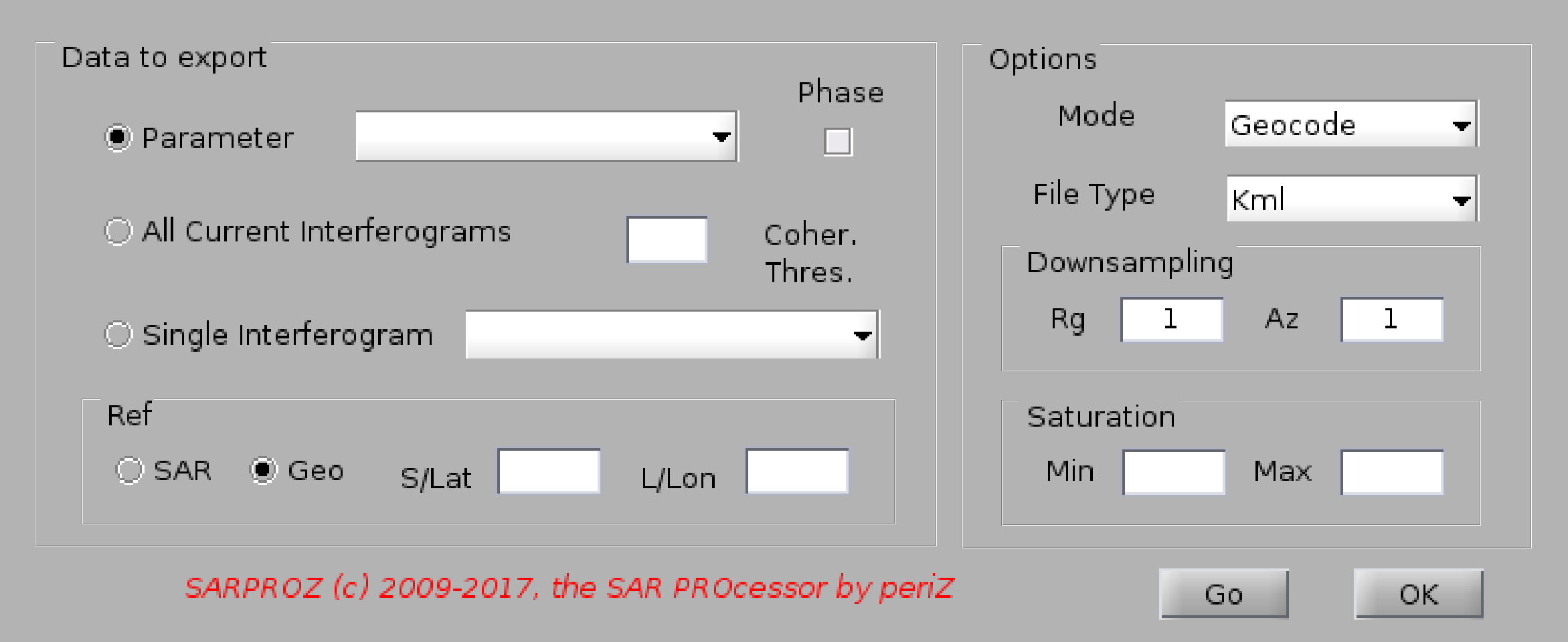
In this module, you can choose among 3 operations:
- exporting a parameter (look at "Load mask" for the full list of parameters)
- exporting current interferograms (according to the currently loaded images graph and to the current InSAR params)
- exporting a single interferogram among the existing ones (the software looks in the directory "INTERFEROGRAMS")
The "Phase" option can be used to resample phase values, which otherwise will be aliased.
When exporting interferograms, you can set a threshold on the coherence.
You can specify a reference pixel/area to be used as reference for the exported values.
You can choose to downsample the data through the inputs "Range" and "Azimuth". By default, geocoding is done in full resolution,
while the orthorectification is downsampled 5 x 5.
Finally, you can saturate the exported data giving min/max values.