Help for Sparse Data Export
With this function, the tool exports data on a point-wise basis.
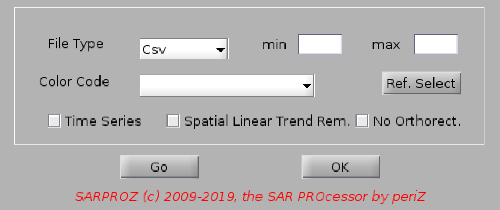
Data can be exported in 3 main formats:
- csv files (text tables in csv format)
- kml files (Google Earth extension)
- absolute 3D kml files (Google Earth extension, where the height is absolute)
- relative 3D kml files (Google Earth extension, where the height is relative to the ground)
Data are color-coded according to the selected parameter ("Color Code").
Look at "Load Mask" for the full list of parameters.
The color can be saturated passing minimum and maximum values ("min" and "max").
A spatial linear trend can be removed by selecting the corresponding check-box.
A reference point can be selected as well (it should have been saved by the "APS estimation" module).
Default reference point is automatically selected.
By clicking on "No Orthorect." you can geocode points (convert from SAR to geographic coordinates)
without using the estimate height. This is useful in cases where the accuracy of height estimation is low
(e.g. in case of Sentinel data) and if you want to have your points aligned with the geocoded SAR images/data.
Finally, time series can be included in the exported data by selecting the corresponding check-box.
The time series export operation is available only if MISP processing options are already loaded.
It means, if after MISP you access this module, the software will use the same options to generate
and export time series.
If no processing options are loaded, use the "time series module" to generate and export time series.
CSV file fields:
ID - point reference id (sequential)
LAT, LON - latitude and longitude
SVET, LVET ľ sample and line, pixel SAR coordinates
HEIGHT ľ relative to sea level (m)
HEIGHT WRT DEM ľ relative to the external DEM (m)
SIGMA HEIGHT ľ height estimation standard deviation
VEL ľ deformation velocity in mm/year
SIGMA VEL ľ velocity standard deviation
SEASONAL - seasonal trend coefficient
CUMUL.DISP. - point cumulative displacement (mm)
COHER - tepomral coherence
IN, FIN - target point on-off model
STDEV - phase standard deviation from estimated model