Help for Geocoding through GCP Selection
With this function the tool geocodes the DataSet through a Ground Control Point.
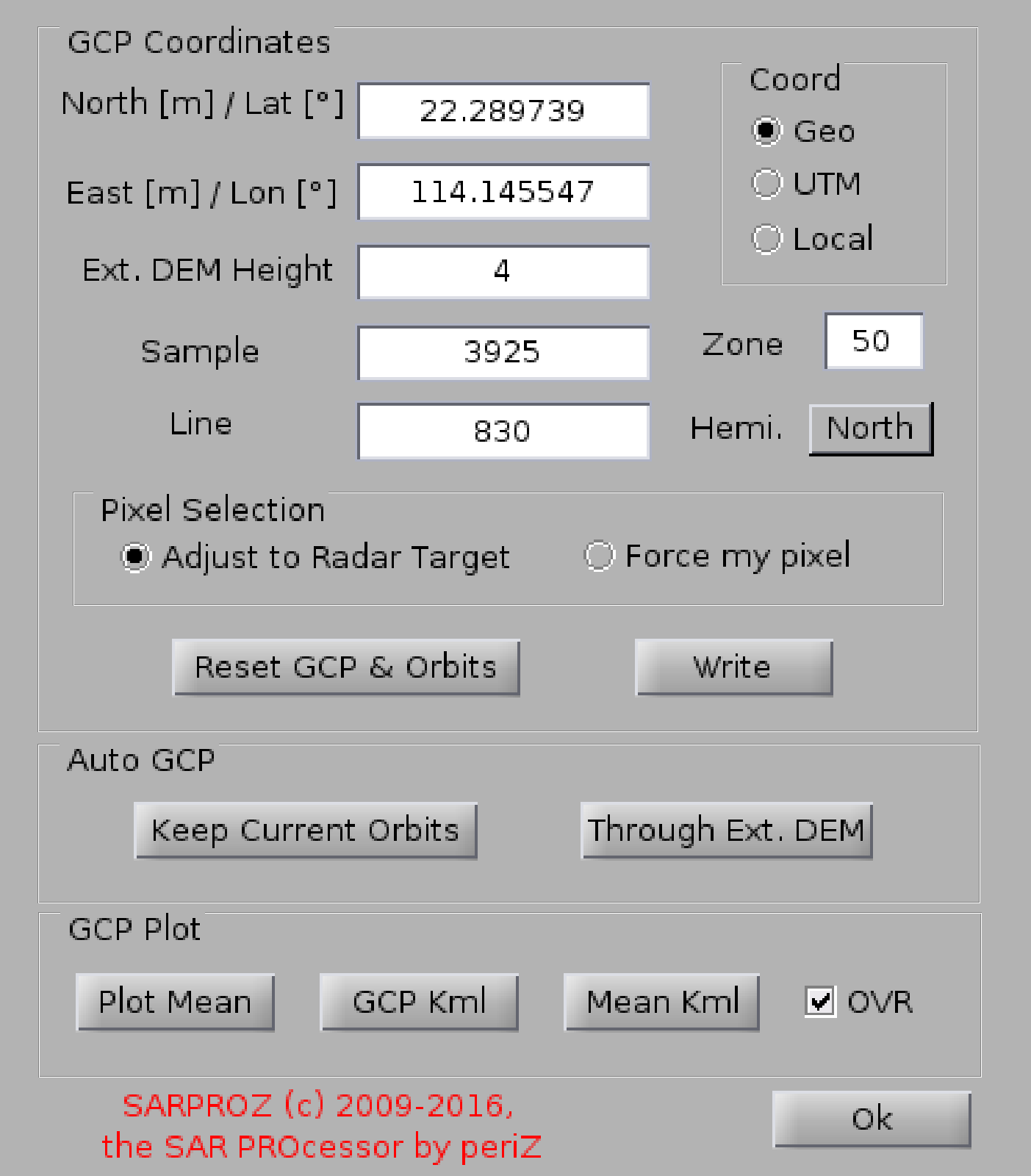
There are 3 options for inserting a GCP:
-manual
-automatic, through the external DEM
-automatic, without changing the current orbital offsets
Manual input:
Insert the GCP coordinates (Geographical or UTM -as for local coordinate systems,
at this moment only the Italian one is implemented-) and its position in the SAR grid
(Sample and Line). The Height is automatically extracted from the Ext. DEM.
After manual inputing, press the button "Write".
In case of errors, the GCP can be resetted and the original orbits are restored.
The GCP can be visualized on the Reflectivity Map (by pressing the button Plot Mean)
or in GoogleEarth (by pressing the kml button).
Also the Reflectivity map can be visualized in GE (downsampling 8 by 8).
The geocoded Refl. Map is read from the disk, unless the option "OVR" (overwrite) is selected.
After changing a GCP, to create a new geocoded Refl. Map and see the changes check the option "OVR".
Reference
D. Perissin, "Validation of the sub-metric accuracy of vertical positioning of PS's in C band",
IEEE Geoscience and Remote Sensing letters, Vol. 5, No. 3, July 2008, Pages: 502 - 506.