Help for Site Processing
Within this window you can choose among many operations to perform on your dataset.
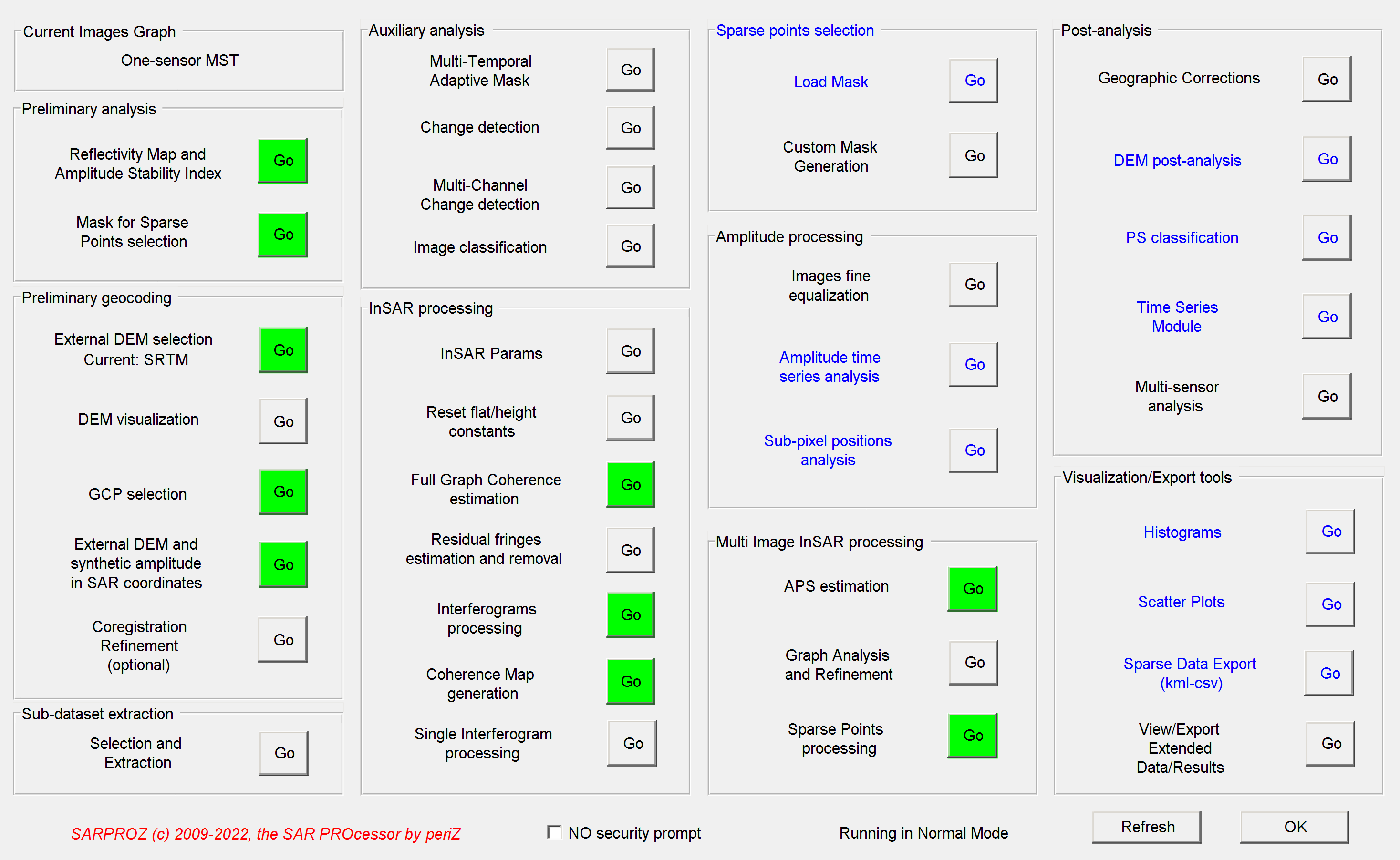
The functions are divided into 10 groups:
-Preliminary analysis (to be performed as first)
-Preliminary geocoding (to correct initial orbit offsets and import external DEM)
-Sub-dataset Extraction (to export a crop of the dataset in a new site)
-Auxiliary analysis (as change detection and image classification)
-InSAR processing (to prepare and perform interferometric analysis)
-Sparse points selection (to select sparse points on which running the functions written in blue)
-Amplitude processing (to process amplitude time series)
-Multi Image InSAR processing (to implement PS-QPS approaches)
-Post-analysis (to be performed after multi-mage InSAR processing)
-Visualization/Export tools (to view/export data and results)
Some buttons are displayed with green/yellow/red colors. Red means that the results of that function were not processed.
Green means that all results were processed and are available.
Yellow means that the results were partially processed (this can happen e.g. after updating the site with a new image).
Some functions are written in blue: those functions apply to sparse points analysis instead of processing all image pixels.
Some functions can be performed without specifying any other options or without opening other dialog windows: to avoid starting
long processing operations by mistake, the user is asked for a confirmation through a window that appears for 5 seconds.
If no confirmation is given, the command is aborted. To avoid such security prompt, you can check the corresponding option
on the site processing window.
Site processing functions are not included in the Demo version.