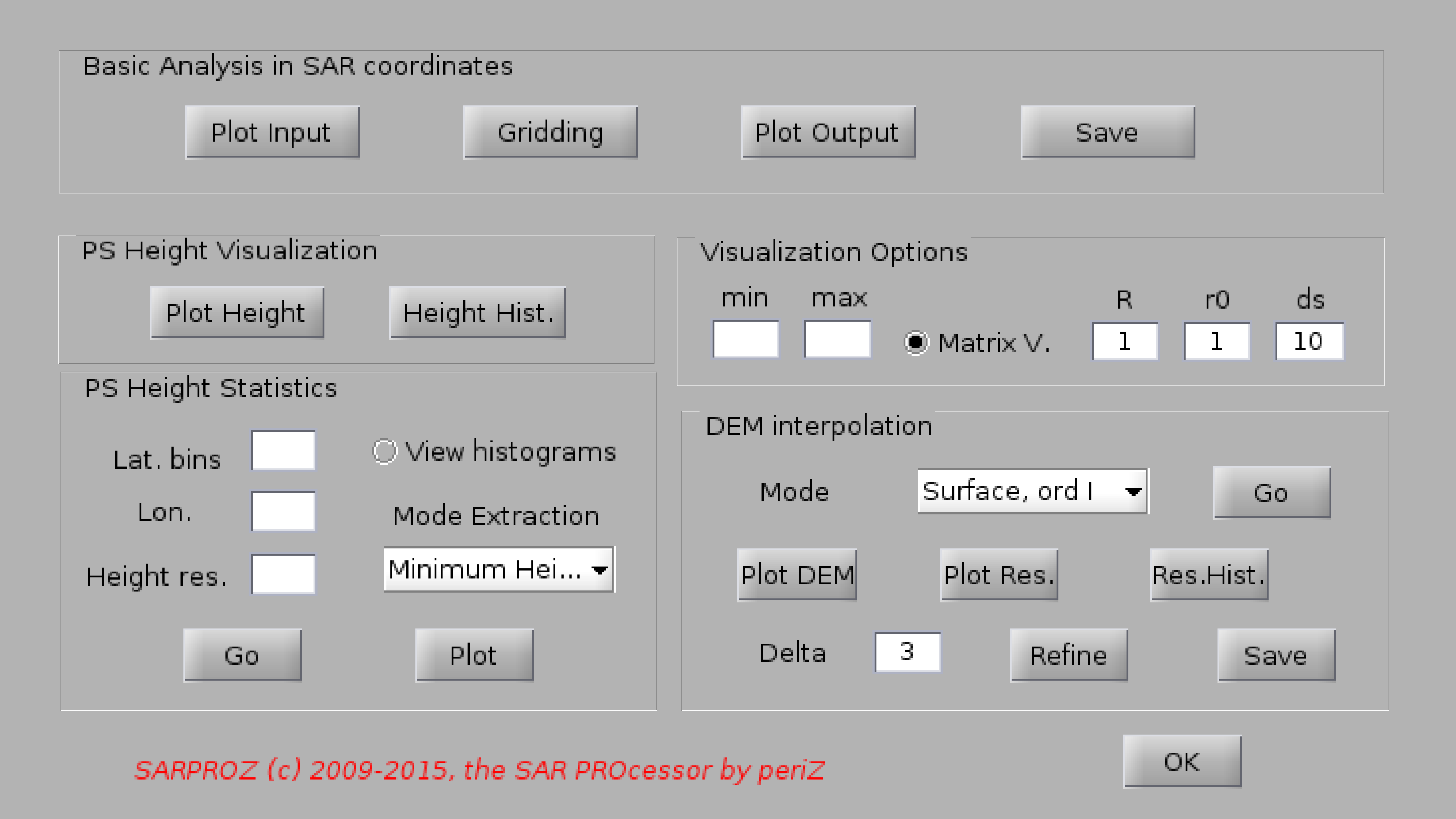
Help for DEM post-analysis
With this function you can post-process the height estimated with the multi-temporal InSAR analysis
for a sparse set of points in order to retrieve a digital elevation map of the are of interest.
In particular, this function has been written for extracting the height of the ground in urban sites
(Digital Terrain Model, DTM) [1,2]. However, you can use the following steps also for generating a common
DEM or a more advanced DSM.
Firstly, you can visualize the estimated height and its histogram using the 2 functions in the
"PS height visualization" box.
Then, you can analyze the height statistics in 3D with the functions in the panel "PS Height Statistics".
To achieve the aim, histograms are calculated by dividing the geographical space into "Lat bins" by "Lon bins" tiles.
The vertical sampling is defined by "Height Res".
The tool extracts a sample for each tile, according to the histogram modes. Currently, aiming at DTM estimation,
two modes can be extracted: the first mode (height with highest frequency) or the mode with lowest height.
When processing histograms, one can choose to visualize them by checking "View histogram". Such visualization
clearly slows down consistently the whole estimation, and can be stopped by pressing ctrl+c in the Matlab command prompt.
After the processing is conclude, the estimated modes can be plotted with the function "Plot".
After sampling the PS height according to its spatial statistics, such values can be interpolated in order to
reconstruct a reference surface for the whole area of interest. Choices are either fitting a mathematical surface
(first or second order), or using the griddata fucntion in Matlab.
Results can be checked by visualizing the estimated surface with "Plot DEM", the height residuals with "Plot Res."
and their histogram with "Res. Hist.".
Finally, results can be saved with "save" assigning a name to the generated file. Results are written in the directory
RESULTS in the main site folder.
[1] D. Perissin, F. Rocca, "High accuracy urban DEM using Permanent Scatterers", IEEE TGARS,
Volume 44, Issue 11, Nov. 2006 Pages: 3338 - 3347.
[2] D. Perissin, "Validation of the sub-metric accuracy of vertical positioning of PS's in C band",
IEEE GRSL, Vol. 5, No. 3, July 2008, Pages: 502 - 506.